ClockSunday, 18/10/2020 21:04

River floods forecasted to occur on 18th – 19th October

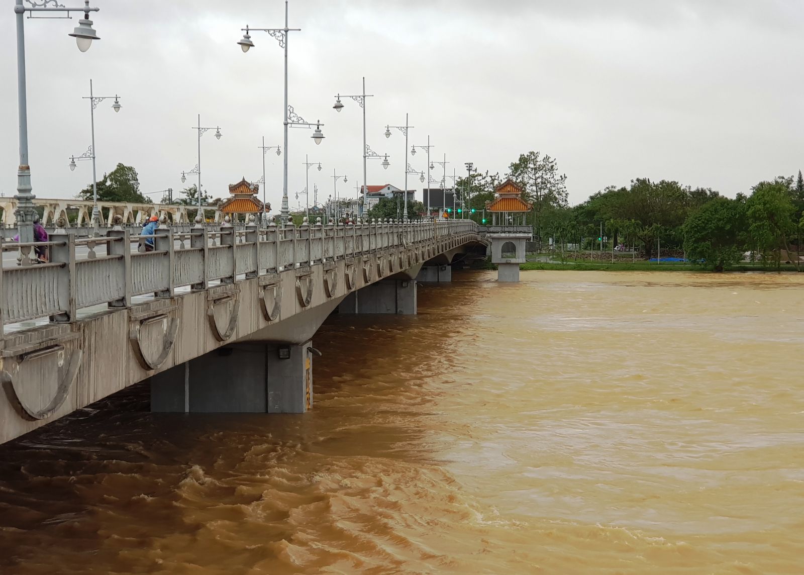
TTH.VN - Due to heavy downpours in highlands, the amount of water flowing to reservoirs has dramatically increased. At 5 o’clock this afternoon, the water level at Kim Long, Phu Oc and Phong Binh Gauging Stations registered 3.47 meters, 4.62 meters and 3.16 meters respectively.

Hue City sets up two working groups to direct and respond to floodGuarding the forest in the flood season

The water level of the Perfume River at 4 o’clock on the afternoon of 17th October

According to the Provincial Meteorological Station, due to the influence of cold air in combination with the tropical convergence strip running through the Central Region as well as the polar easterlies, there will be moderate, heavy to torrential rain on 18th – 19th October, with overall precipitation of 150-300 millimeters and of over 300 millimeters in some places.

From 18th to 19th October, there are high risks of river floods. The flood summit may reach approximately alert level 3. 

At 5 o’clock this afternoon, the water level at Kim Long, Phu Oc and Phong Binh Gauging Stations registered 3.47 meters, 4.62 meters and 3.16 meters respectively.

Currently, the amount of water flowing to the reservoirs is rising significantly. These reservoirs are continuingly operating in coping with floods.

While the flood water has not yet receded, the water level is rising again in low-lying areas of the districts of Quang Dien, Huong Tra, Phong Dien, and so on. Landslide and property damage also occurred in some places.

Together with evacuating people in critical areas to safe places, authorities and organizations at all levels are supporting residents in flooded areas with necessities.

Below are some images captured by Thua Thien Hue Online on the afternoon of 17th October

Flood water overflowing Nguyen Trai street at 4 o’clock this afternoon

Travel limit being imposed on some roads in low-lying areas in the city

Residents purchasing some devices such as hurricane lamps, power banks, etc., in preparation for power outages.

One route in Thuan An Town (Phu Vang District) is still available while others having been restricted.

Residential areas in Phong Binh Commune, Phong Dien District being deeply submerged. 

The flood water level being high at the Entrance to Thanh Phuoc Village, a low-lying area in Huong Phong Commune, Huong Tra Town. 

Checking practices at critical areas are maintained on a regular basis. The photo shows functional forces of Phu Mau Commune preparing supplies for households in flooded areas.

By TTH

RATING
Be the first to review this post!
  Comment

YOU MAY CARE ABOUT

History of natural disasters in Hue and experiences in prevention

Thua Thien Hue, with a coastline stretching 120 km, is vulnerable to typhoons and storm surges from the East Sea. Throughout history, Hue has endured severe storms, floods, and droughts, which have had significant impacts on human life, architectural structures, and the natural environment.

History of natural disasters in Hue and experiences in prevention
Son Xuyen Esplanade - The remaining mark

Few people know that within the premises of the Phuong Duc Primary School at 245 Bui Thi Xuan, Hue City, there exists the only remaining mountain and river deity worship place in the country today - the Son Xuyen Esplanade.

Son Xuyen Esplanade - The remaining mark
Everyone preventing and fighting back against floods

Heavy rain throughout November 15 caused thousands of houses in key areas across the province to be seriously flooded. The flood also inundated and divided many low-lying areas in Quang Dien, Phong Dien, Phu Vang, Phu Loc districts, etc.

Everyone preventing and fighting back against floods
At the end of the river

It is the Huong River, the river that "embraces Hue in its heart", which is also a priceless gift that nature has dedicated to this place. The Huong River is magnificent from the upstream, with a peaceful beauty and full of poetry as it confluences and hugs around gardens and villages such as Kim Long, Nguyet Bieu, Vy Da, Gia Hoi, Bao Vinh, and Sinh village, etc. And then, before pouring water into the sea, the downstream river area is a place to make a living, which is hard but close and dear to the locals.

At the end of the river
The legend of grass

Legend has it that at the water source of the Perfume river there is a type of aromatic grass named thach xuong bo. This grass grows prolifically along rivers and streams making their water fragrant. The river is hence named Perfume meaning the river of fragrance.

The legend of grass
Return to top